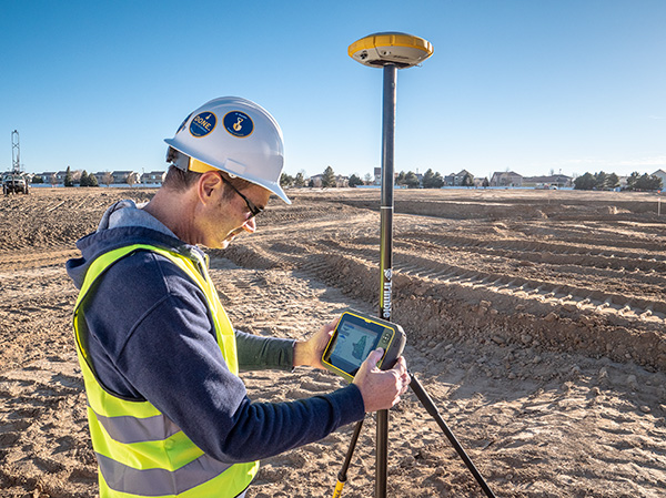
Construction projects require precision and accuracy, and traditional surveying methods can be time-consuming and labor-intensive. This is where GPS surveys come in. A GPS survey is a modern, efficient way to get accurate measurements of land or structures. In this blog post, we will explore what a GPS survey is, how it differs from traditional surveying methods, and why it is beneficial for construction projects. We will also discuss the advantages of using GPS surveys in construction, including increased accuracy, speed, and cost-effectiveness. If you are involved in the construction industry or planning a construction project soon, keep reading to learn more about how a GPS survey can benefit you.

What is a GPS survey?
A GPS survey utilizes satellite technology to accurately determine the position and collect data. It provides precise measurements of points on the Earth’s surface, including latitude, longitude, and elevation. This surveying method involves the use of GPS receivers and reference stations and is widely used in construction and engineering industries.
How is a GPS survey different from traditional surveying?
GPS surveys revolutionize traditional surveying methods by utilizing satellite signals instead of manual tools. This enables faster data collection, real-time positioning, and increased accuracy. GPS surveys cover larger areas and can be conducted in challenging environments, making them a game-changer in the construction industry.
Advantages of using a GPS survey in construction
Using a GPS survey in construction offers numerous advantages. Firstly, it provides accurate measurements for site planning and design, ensuring precise positioning of infrastructure elements such as roads and buildings. Secondly, GPS surveys greatly enhance construction project efficiency by reducing costs and improving coordination between different teams. Additionally, they enhance safety by providing real-time location information for workers and equipment. The use of GPS surveys also enables better decision-making through reliable data on navigation and mapping. Finally, GPS surveys offer a more efficient alternative to traditional methods, eliminating the need for manual calculations and allowing for faster data collection.
Why use a GPS survey in construction?
GPS surveys in construction offer numerous benefits. They allow for faster and more efficient data collection, accurate measurements for project planning, real-time monitoring of progress, error reduction, and improved communication between stakeholders.
What is a GPS survey and how does it differ from traditional surveys?
A GPS survey utilizes satellite technology to determine precise coordinates and elevations, unlike traditional surveys that rely on manual measurement tools. GPS surveys are faster, more accurate, and can cover larger areas, making them ideal for construction projects requiring precise grading and excavation.
What are some of the benefits of using GPS surveys in construction projects?
Using GPS surveys in construction projects offers numerous advantages. Firstly, they provide accurate and precise measurements, ensuring that projects are built to specification. Secondly, they save time and money by reducing the need for manual surveying. Additionally, GPS surveys enable real-time tracking of equipment and materials on-site, enhancing efficiency. Lastly, they help prevent errors and reduce safety risks during construction.
How can GPS surveys improve accuracy and efficiency on a construction site?
GPS surveys play a crucial role in enhancing accuracy and efficiency on construction sites. By providing precise location and elevation data, they minimize errors in construction. Real-time tracking of equipment and personnel allows for better coordination and increased efficiency. Additionally, GPS surveys aid in identifying potential hazards, improving safety measures. Ultimately, these surveys streamline construction processes, reducing project timelines and costs.
GPS surveys have revolutionized the construction industry by providing accurate and efficient data collection. By utilizing satellite technology, GPS surveys offer numerous benefits over traditional surveying methods. They save time, improve accuracy, and enhance productivity on construction sites. With real-time positioning and precise measurements, GPS surveys enable better decision-making and planning, leading to cost savings and reduced rework. Additionally, they enhance safety by minimizing the need for workers to physically access potentially hazardous areas. Embracing GPS surveys in construction projects is essential for staying competitive in today’s fast-paced industry. So, if you’re looking to optimize your construction processes and maximize project success, incorporating GPS surveys is a wise choice.
CD Surveys Ltd Land & Building Surveyors
The Stables, Pentire, Fordingbridge Road, Sunbury-on-Thames TW16 6AX, United Kingdom
+44 1932 761196
